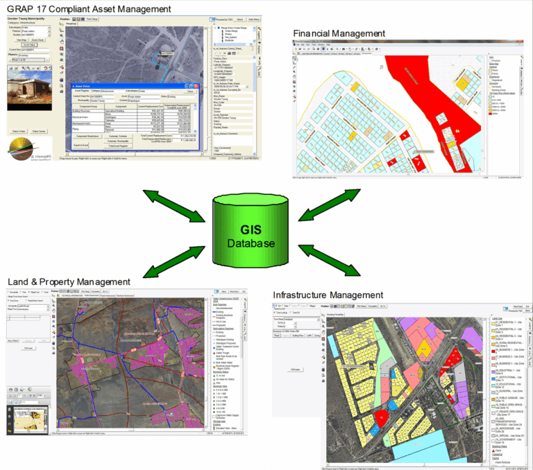
Geographic Information Systems (GIS)
Using advanced spatial technology and infrastructure mapping systems, ECA Consulting provides GIS solutions that improve planning accuracy, project coordination, and infrastructure management for municipalities and engineering developments across South Africa.
GIS Services
Our services include:
Spatial data analysis
Infrastructure asset mapping
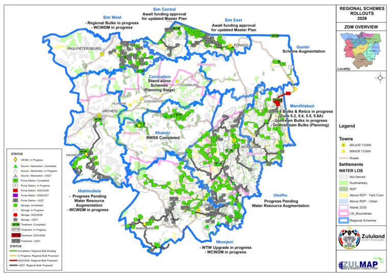
Municipal Asset Mapping
Water Network Mapping
Sewer Network Mapping
Infrastructure Monitoring
Utility Mapping
Spatial Planning Support
Development Planning
Survey Data Integration
GIS Database Management
Geographic Reporting & Analysis
Infrastructure Information Systems
As-Built Mapping & Records
ECA Consulting combines engineering expertise with advanced GIS technology to provide accurate infrastructure intelligence and mapping solutions for municipalities and development projects.
GIS Capabilities
Our GIS systems support:
Long-term infrastructure planning
Asset management
Water demand analysis
Municipal infrastructure tracking
Development coordination
Project monitoring and reporting